mapSenegal
Administrative Boundaries of Senegal
The administrative boundaries of Senegal are provided at several levels, including regions, departments, arrondissements and communes. The Global Administrative Areas database, or `GADM` < https://gadm.org/>, is the primary source for these layers. The dataset is complemented by the incorporation of additional geographic layers, such as localities, universities, roads, or health facility locations.
mapSenegal 
The goal of mapSenegal is to provides access to administrative
boundaries of Senegal at several levels (regions, departements,
arrondissements and communes). These boundaries are based on
GDAM. The package also gives access to
roads, localities, universities and health facilities locations.
Installation
You can install the development version of mapSenegal with:
# install.packages("remotes")
remotes::install_github("rCarto/mapSenegal")
Examples
This is a basic example which shows you how to use the package.
library(mapSenegal)
#> Loading required package: sf
#> Linking to GEOS 3.13.1, GDAL 3.10.3, PROJ 9.6.0; sf_use_s2() is TRUE
library(mapsf)
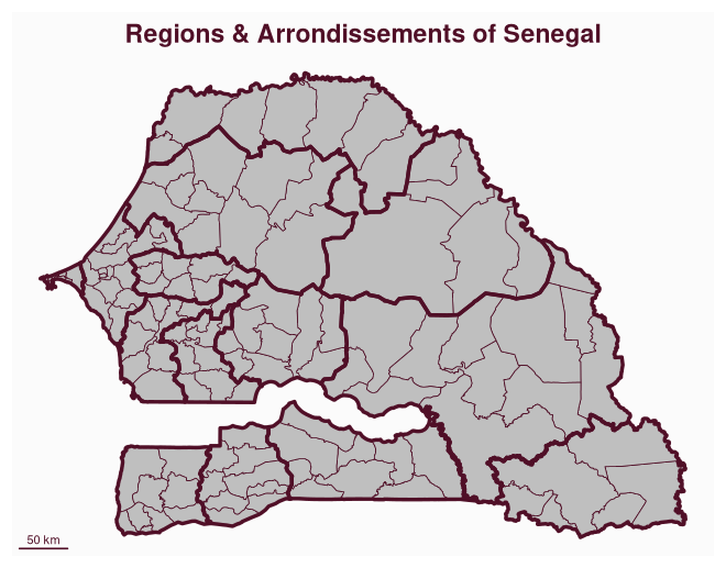
reg <- sn_regions()
ardt <- sn_arrondissements()
mf_map(ardt)
mf_map(reg, col = NA, lwd = 3, add = TRUE)
mf_scale(pos = "bottomleft")
mf_title("Regions & Arrondissements of Senegal")
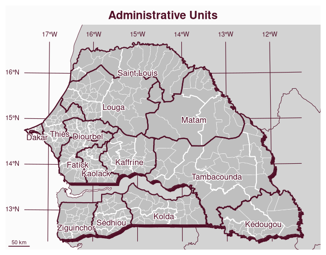
The following maps shows the different layers provided by the package.
# import
pays <- sn_country()
zone <- sn_neighbors()
reg <- sn_regions()
dep <- sn_departments()
ardt <- sn_arrondissements()
com <- sn_communes()
loc <- sn_localities()
hf <- sn_health_facilities()
univ <- sn_universities()
roads <- sn_roads()

mf_map(pays, col = NA, border = NA, expandBB = c(0, 0, .05, 0))
mf_map(zone, col = "lightgrey", add = TRUE)
mf_shadow(pays, add = TRUE)
mf_graticule(pays, add = T)
mf_map(com, lwd = .5, add = TRUE, border = 0)
mf_map(dep, lwd = 1.5, add = TRUE, col = NA, border = 0)
mf_map(reg, col = NA, lwd = 2, add = TRUE)
mf_label(reg, "NAME", halo = TRUE, cex = .9, pos = 1)
mf_scale(pos = "bottomleft")
mf_title("Administrative Units")
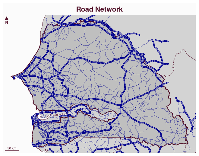
mf_map(pays, col = NA, border = NA)
mf_map(zone, col = "lightgrey", add = TRUE)
mf_map(pays, lwd = 2, add = TRUE)
mf_map(subset(roads, TYPE %in% 4:5), col = "darkblue", lwd = .5, add = TRUE)
mf_map(subset(roads, TYPE %in% 1:3), col = "darkblue", lwd = 4, add = TRUE)
mf_map(subset(roads, TYPE %in% 1:3), col = "white", lwd = .5, add = TRUE)
mf_arrow()
mf_scale(pos = "bottomleft")
mf_title("Road Network")
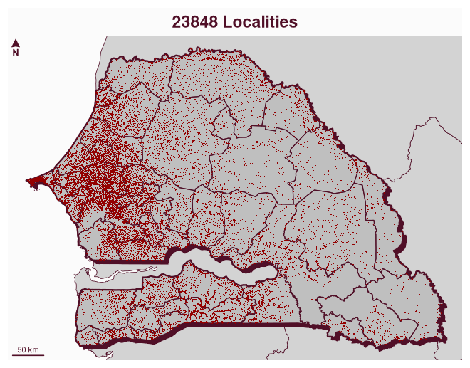
mf_map(pays, col = NA, border = NA)
mf_map(zone, col = "lightgrey", add = TRUE)
mf_shadow(pays, add = TRUE)
mf_map(pays, lwd = 2, add = TRUE)
mf_map(dep, col = NA, lwd = 1, add = TRUE)
mf_map(loc, pch = ".", col = "#940000", add = TRUE)
mf_arrow()
mf_scale(pos = "bottomleft")
mf_title(paste0(nrow(loc), " Localities"))
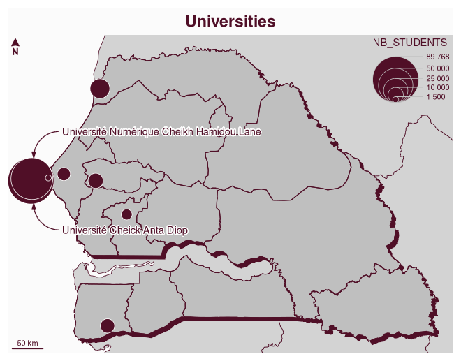
mf_map(pays, col = NA, border = NA)
mf_map(zone, col = "lightgrey", add = TRUE)
mf_shadow(pays, add = TRUE)
mf_map(pays, add = TRUE)
mf_map(reg, col = NA, lwd = 1, add = TRUE)
mf_map(univ, "NB_STUDENTS", "prop", leg_val_big = " ")
mf_annotation(
  x = c(239471, 1655820),
  txt = "Université Numérique Cheikh Hamidou Lane", halo = T
)
mf_annotation(c(239471, 1595149),
  txt = "Université Cheick Anta Diop", halo = T, pos = "bottomright"
)
mf_arrow()
mf_scale(pos = "bottomleft")
mf_title("Universities")
mf_map(pays, col = NA, border = NA, expandBB = c(0, 0, 0, .1))
mf_map(zone, col = "lightgrey", add = TRUE)
mf_shadow(pays, add = TRUE)
mf_map(pays, add = TRUE)
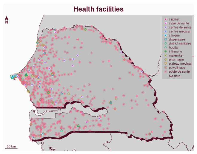
mf_map(hf,
  var = "TYPE", type = "symb", cex = .75,
  pal = "Dark 3", add = TRUE, leg_title = "",
  leg_pos = "topright", leg_frame = TRUE
)
mf_arrow()
mf_scale(pos = "bottomleft")
mf_title("Health facilities")